
")
Location and access
Majunga (Mahajanga in Malagasy) is the third most populous city in Madagascar (250,000 inhabitants) and the largest city on the west coast, overlooking the mozambique canal.
The distance by road to Antananarivo is 570 km (10h drive) and 380 KM by plane
France (Mayotte) is only 360 km distant
The international airport, located in Amborovy is 8 KM from the center of Majunga and 7 KM from Somaroala. It is more like a small town aerodrome with its light infrastructure regularly servicing only 2 destinations, Dzaoudzi and Antananarivo, which however allows to put Majunga 13 hours of Paris. Be careful though, there are no flights every day ...
The bus station in the immediate vicinity of the city is 5 km from Somaroala, because you have to cross the whole city.
Let's look at the first map: We locate the city below, the airport at the top and the Somaroala domain to the west of the city. The great particularity of its location is that Somaroala is located on a small sandy peninsula.
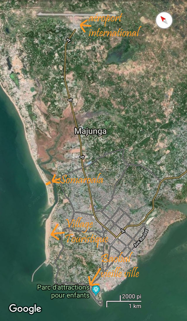
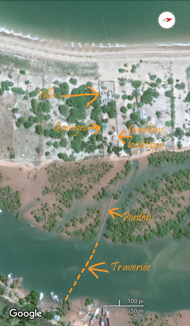
below a zoom with a map now facing west.
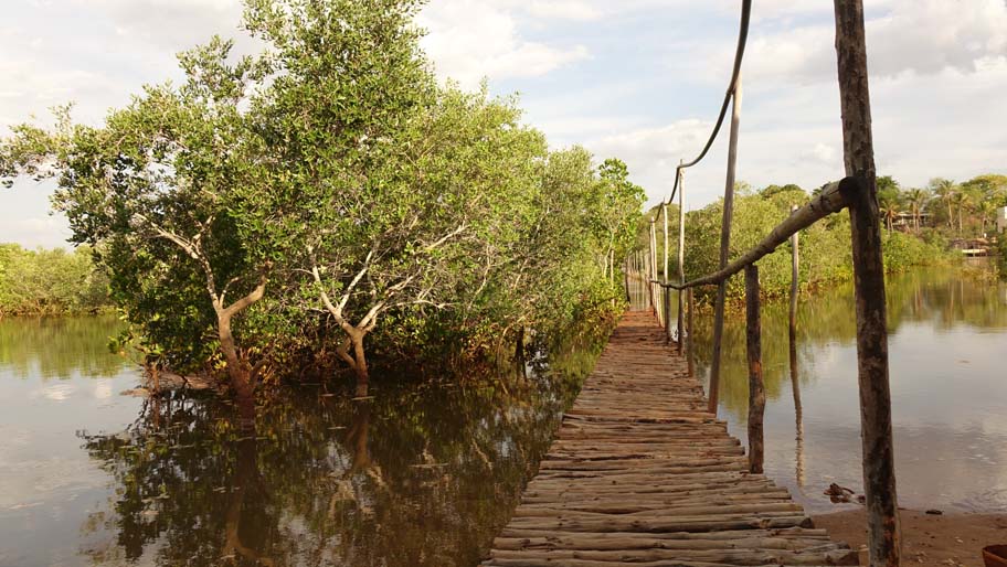
The first map is oriented almost to the north. The beach is almost deserted and access can only be done by the beach from the north or by a picturesque boat trip of the hundred meters that separates the village of sinners from the mangrove. Then, to the ground, it is the tide that decides: the remaining 100M continues in boat at high tide and a wooden pontoon at low tide.
A small daily adventure that isolates from the hustle and bustle of the city!
This access is not suitable for people with reduced mobility.
Do not wait to come to this little paradise hitherto protected by its atypical access because .... A project in two phases deposited at the town hall is in progress. The first phase, the completion of two poles for tourism, is completed, the second is the extension of a road 2 times 2 ways with a bridge that will connect the small peninsula to make it the third touristic pole of Majunga, for its beaches up to now deserted ...
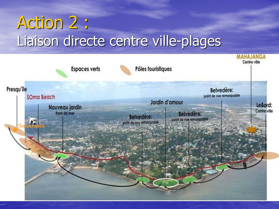
Photo of phase 1 finalized
